Sunday, November 26, 2006

Backcountry Road Ride

Thanksgiving weekend provided a nice 4 day break from the grind.

Backcountry Road Ride
I got in a long road ride from Murfreesboro through Las Casis to Spain Hill and back. Took this picture with my camera phone at the farthest point of the ride. Notice the street sign is nailed to a tree, and the road is narrow and rough. This is way out in the country. The trees had grown up to the road and there were places where the road went through a creek.

Saturday, November 25, 2006

Busternut #2

Busternut 2
Busternut was a blast. The start was at the bustling Market Square during the UT vs. UK football game. Ice skating was in full session,in the middle of the square, and vendors in tents set up around the businesses. It was a crisp clear sunny fall day with nearly 100 bikers at the start. The short but sweet race sent us to 4 checkpoints around downtown.

Monday, November 20, 2006

Thirty-Two Candles Ride

I'm another year older and wiser, and have a few more miles under my belt. The annual trip to the mountains of North Carolina on my birthday weekend couldn't have been more beautiful.
Like the yin and the yang, we experienced the duality of the mountains of this area. The rugged and steep ranges that run through Pisgah Forest provided high elevation riding and long descents while DuPont State Forest is comprised of more rounded and mellow terrain which makes for "Dukes of Hazard" style fast runs through flowing ridgeline trails.
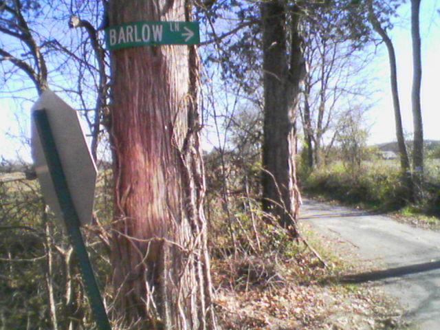
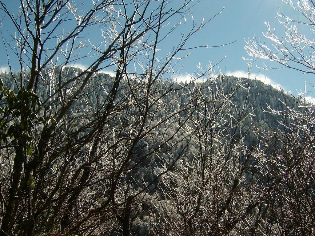
The Laurel Mountain Ride
We headed out in the early AM fog, on Saturday morning, much like my cob-web-filled head after the previous nights birthday celebration at Union Jacks. The plan for the day was to do a ride up to the top of Laurel Mountain, so we parked on the forest service road at Yellow Gap. The trail from there is a gradual climb that winds its way up to above 4800'. We worked our way up slowly, making a steady pace that felt good on a clear day. The leaves were all down and we had views all around of the Blue Ridge Mountains. It was a juggling act to take in the scenes, yet negotiate the rocky terrain. In and out of Laurel tunnels, we spun our way up, reserving energy for the long downhill ahead. After an extended rest we made the final push to the summit, which was tree covered, yet still had the feel of a high mountain peak (where we turned onto Pilot Rock). Mid-way into the downhill was the expansive vista. We had a planned stop there, to take in the view and get a feel for just how insignificant we are in the scheme of things. The mountains felt huge all around us. We just sat there staring off the overlook, and all we could say was, “wow”.
We got back on the bikes in the rock garden and continued blazing down the mountain dropping elevation fast and hard as we worked overtime picking split-second lines through boulders and switchbacks. I waited at the bottom of the 3.6 mile and 2,000' vertical descent, grinning ear to ear. We gathered back up and slapped high fives, we were off to find more trails.
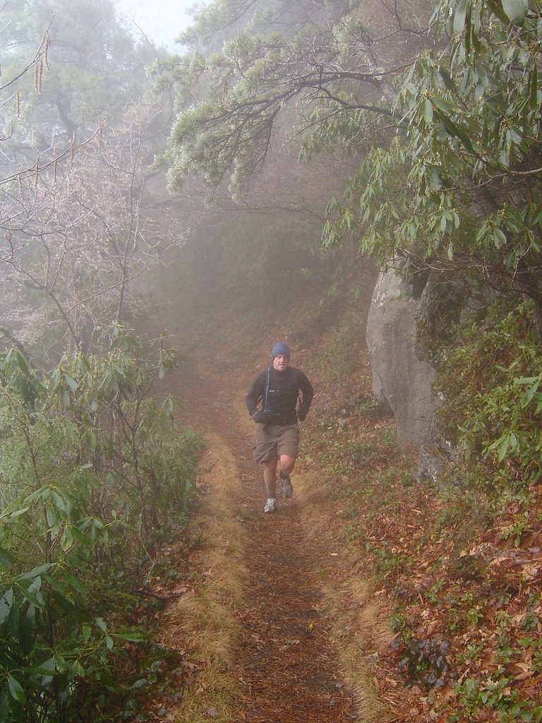
We hadn't made it far into Pilot Cove, when TJ snapped his derailleur hanger. The mechanical forced TJ to pull a solo hike back to the truck on a 4 or 5-mile stretch of steep gravel road. Chris and I continued up the Pilot Cove-Slate Rock trail, that winded along waterfalls and stream crossings...

DuPont State Forest
I was in charge of the map for this group of 5, so while Chris, TJ and myself waited on the group from Knoxville to arrive (to the trailhead), we climbed up Big Rock, enjoyed the view, then turned around and rolled down its slickrock and shelved terrain. We made it back into the lot just in time to meet the smaller than expected group of Ben and DJ. But five ended up being the magic number.
The collective headed back up to Cedar Rock Trail and down to Bridal Veil Falls, where we climbed down and hiked under the waterfall to the other side. It was intensely loud behind the sheet of water; it felt like I was dreaming this "last of the Mohicans-style wilderness adventure." When we emerged on the other side, the group was still a little uncertain about the route, because we had to climb through mountain laurel to get down along the rocky banks, which took us to the trail. We were all smiles again, after we were back on the trail. But, I may have been the only one that realized we still had to get back on the other side before the day was over.
We climbed up to an old airstrip at 3,200', where we had a great view of the mountains all around us. The downhill from here flowed along the bench-cut contour trails, hitting jumps and berms like the "sheriff" was chasing. Spinning and grinning, we continued onto Reasonover Creek Trail and worked our way back up. I particularly enjoyed this trail because the leaves were down and it offered a glimpse into the topography of this park that I had not fully understood until seeing it on this day and in this way. The gentle rolling mountaintops and ridgelines jumped out with the taller mountains of Pisgah in the background. This is Shangri la.
I felt like I couldn't run out of power, the harder I pushed, the more I had to give. I found the edge in many ways, and I pushed it right up to that limit. Shredding corners on leafy trails, finding perfection in the distortion.
We climbed Mine Mountain, and following its descent was where we would have to forge the high flowing cold waters of the creek. The group protested and reluctantly crossed. It was a cold November day, but that was the only way through. So I went for it without thinking. With a bad case of clawfoot, I had lost feeling in my toes and my feet felt like hooves. It was an hour after the ride before I regained feeling.
The last trail left was Burnt Mountain, but Chris and TJ had had enough, so we split up. A year ago, the climb up Burnt Mountain would have sent me on a vision quest, summoning the inner strength to survive. But, I am in peak shape and therefore climbed to the top effortlessly. The final descent was the steepest and fastest of the day. We were boosting 4-foot drops hollering like Bo and Luke Duke.
My memories of the weekend resembles a rock video. Distorted and loud. Fast and fun. Legendary.

Monday, November 13, 2006

Its Better to be Sorry than Safe

Many of my best memories were born out of spontaneity. Irresponsible athletic accomplishments are no different. Like deciding, (the night before) in a bar, to enter the 12 Hours of the Hill of Truth (solo), and on a whimsically purchased and never before ridden steel hardtail and rigid singlespeed bike.

In the immortal words of Jim Dandy, “Always do sober, what you said you would do drunk.” Running to the top of Mt. Leconte is another pursuit of irresponsible confidence. The peak of Mt. Leconte sits at 6,593 ft. above sea level. We started our journey at about 2,500 ft.

We set out in the fog of the Smoky Mountains, heading up Rainbow Falls trail, arduously climbing through the rocky path littered with creek crossings. The fog broke slowly and the misty mountains began to reveal themselves. Covered in a dusting of snow and ice, the forest was postcard perfect in the higher elevations. It wasn’t until we got up over 5,000 ft. that we rose above the clouds and into the blue sky.


At the top it was in the low 20’s and the wind was piercing. We were not dressed for a long stay, and I was the only member of our 3-man team (Duey, Erin and myself) to climb to the final .2 mile to the rocky summit. The slippery ice covered climb was difficult and the uninhabitable top of the mountain was beautiful and fierce.
The run was 13.6 miles roundtrip covering over 4,000 ft of vertical. It took 5 hours to complete.

Tuesday, November 07, 2006

Sheltowee Trace

This ride is in the early planning stages, but is hopeful for a July date. I am plotting a trail ride that would run the Sheltowee Trace trail from Morehead Kentucky to London Kentucky. This backcountry trail undulates through rugged and steep terrain . Ride length is yet to be determined, but will be a long ride (the full length of the Sheltowee is 269 miles.)

http://www.sheltoweetrace.com

2006

Life in Knoxville has brought about several changes, and a year after the move I'm a more well rounded rider. I have broadened the scope of my riding to: road, cyclocross, downhill, freeride, enduro, alley cat racing, cross country, epic mountain biking, urban assault, singlespeed, 29"ers, greenway riding and the combination of any of the above with the infamous booze cruise.

Fueling the motivation to ride, Knoxville is perfectly located to be in short reach of the best trails the southeast. And if riding in the mountains builds character, I'm working on writing a book. But character wears thin, you have to continually renew character, so I go back frequently.

So after a year of riding harder trails and longer rides more frequently, I'm happy with my performance in what I consider my rookie year. Biting off some big rides and doing well is something I wouldn't have expected for myself a few years ago.

Sunday, November 05, 2006

Salvage the Ride


Where is the line between an epic ride and a tragic ride. How long is an epic ride? How far? How lost? How cold or how wet? Can a ride be an epic if the weather is beautiful and the views spectacular? How bad does it have to hurt?

Pisgah National Forrest plays host to what's known as the Swank 65 mountain bike race, infamous in the south east for its self proclaimed devilish terrain. A grassroots organization of two fellow cyclist throw this backcountry race together under the name Mountain Goat Epics. This is the same group that puts on The Off Road Assault on Mt. Mitchell.
The race is held in the area of the fish hatchery, and starts in the Cove Creek campground. The ride covers 42 miles, or 65k, of steep trails and logging roads including the burly descent from one of the highest peaks in the park down Farlow Gap. The addition of the Farlow Gap trail, to this years course, weeded out some potential participants and lured others. I fell in the middle with a respectful fear for the landsacpe of the old mountain.
The reverence for the land was not enough to get my head around the difficulty of this ride. 42 miles in Pisgah Forrest is not your average 42 miles, and I knew that going in. But like the memory of the long descent, I always seem to forget the struggle to the top.

Cove Creek Campground warmed up to 37 degrees by the start, from an early morning 28, that we thankfully missed from the breakfast bar of our hotel. The Leman's start kicked off the ride, and after a jog through the woods we were on our bikes and into the long climb, which set a president for a long day. The word "long" can be used in front of every adjective from here through the end of the story.
I took off strong from the get go, holding a pace that I only now realize would not be sustainable for the duration. I hammered through the first 20 miles into Goulester Gap. With my head down, I missed the race tape and took a logging road to the bottom of a cove, which I was forced to climb back out of, and back onto the trail. This set me off, and it was hard to mentally recover from that mistake. I ended up pushing way to hard to catch up and by the time I made it to the first rest stop I was famished.
I stayed too long, at the first rest stop, eating everything I could shovel down. (Potato chips and cookies in the same bite.) The entire Harper's crew passed me as I stayed at the rest stop refueling. I knew at this point that I could only salvage this ride.
I strolled out, with a smarter pace this time, rocking with the headphones on. The next loop put me back in the game, after a lung busting climb up Longbranch I settled in for a long descent, blasting down through the laurels. At the bottom, I gathered my witts and climbed up to the rest stop.
I didn't stay long, I knew the next climb would be difficult. The climb took us up to 4,500' along a massive ridgeline. The gap between two peaks, named Farlow Gap,was the top of a long backcountry descent that takes you into Daniels Ridge. I came into this descent cool, knowing that I needed to ride smart. As the pitch steepened and the boulders got larger and looser, I stayed up and worked my way down passing several people. It was a particularly difficult day on this strecth of trail, with the leaves fluffy and thick in parts.
I crossed the waterfall section, carying the bike, barely recognizing the beauty of the massive rush of of whitewater. With my eyes on the prize, I kept moving through the hike-a-bike climbs, and grunted my way out of the woods by way of Daniel Ridge.
I came into the finish, claiming 13th on a poorly marked course, realizing later that I was not the only rider that wandered off the course and even the course volunteers flagged me into the wrong trail. I spent a good part of the day navigating, so when I came into the finish, I was unsure I was even on the right trail. It turns out that about 50% finished one way, and half went the other. For an $80 race, I would expect more, but who cares, it was a long day on the bike. I'll get my $80 worth from the keg...

Wednesday, November 01, 2006

The Truth Behind the Co-pay


I was more destroyed after the Hill of Truth than I remember feeling after past races. Yet,it took a couple days before I broke down and shelled out the $30 co-pay to have the doc check out my wrist. It's swollen and I can feel something dragging across my bone when I move my wrist. Its in a brace now, and it turns out that I have a case of acute tendinitis.
In related news, I bought a new Rock Shox Reba 29er fork.

It is another rainy midweek and I'm busier than ever with work, like all pre-race weeks. I'm scrambling to get my gear together, which is made difficult by the fact that my house caught fire and caused major damage (a week ago). We are living in a temporary apartment while all our possesions were either lost in the fire or being cleaned by a restoration company. I have no camping gear and many other possesions remain missing. Therefore, it looks like we'll be sleeping swank in a hotel for the SWANK 65.
I had not mentioned the fire earlier because of a few things, first being lack of internet access, but also that I have been trying to keep this site dedicated to the harvesting of sweet rides. The fire has been a huge experience for us, but we have handled it well. At this point its become a wait. Fortunately, our insurance company has been great. We have not had to go without. Its just a hassle.